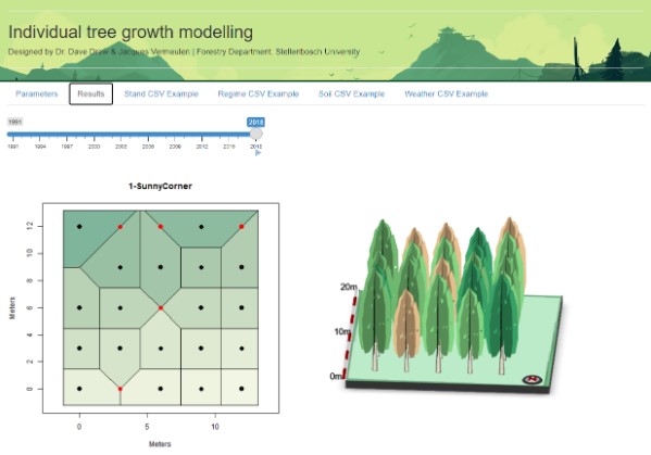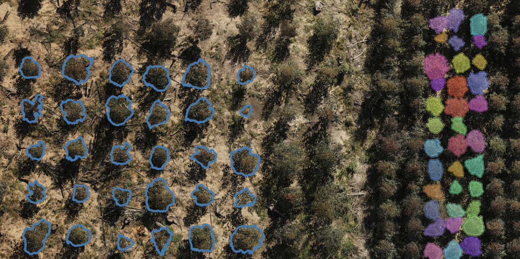
At the IMPACT OAL site on Lourensford farm, the EucXylo research group integrates drones, satellites, and aircraft to capture high-resolution spatial, spectral, and temporal data.
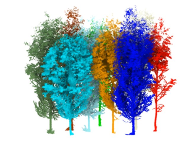
Jacques Vermeulen’s MSc project, EucVision, now focuses on exploring the use of aerial remote sensing via drones to monitor weekly crown dynamics of juvenile Eucalyptus trees. His research investigates how five Eucalyptus species and five planting densities influence canopy development across seasonal transitions.
Key parameters, such as crown diameter, tree height, vegetation indices, and leaf characteristics, are monitored to enhance understanding of growth, stress, and competition in young Eucalyptus stands.
By narrowing the focus to drone-based data, this project offers a detailed, scalable approach to studying forest structure and function, contributing to precision forestry and sustainable plantation management.